Please access the interactive maps via links accompanying the photos, as they will allow you to explore the alignments discussed here.
Map created with help from Mike Clelland. Visit Mike’s site Hidden Experience for more insights into synchronicity, ET contacts, and other curious topics.
Crop circles, UFOs, and synchronicities are clues to our connection with a largely-unseen web of reality. Our interactions with these phenomena demonstrate that we aren’t isolated packets of consciousness, but that we are transmitters and receivers of meaning through language.
We find that where these extraordinary phenomena occur in conjunction with one another and are then plotted on a map, a brilliant and always-evolving syntax emerges. As we wish, we are given to explore a language that has nothing to do with the describing the mundane and everything to do with navigating the fringes of reality.
In this first of two posts, I’ll lay the framework for an upcoming report detailing my ongoing exploration of what these alignments may mean. Of course, like all the great mysteries of life, our understanding of this elusive level of reality is ultimately subjective, so I invite you to draw your own conclusions.
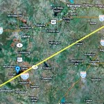
 ONE: The Topeka-Inman Line. This straight alignment in Kansas is comprised of three interrelated locations: 1) the place where I privately wished for a crop circle, 2) the place where I learned about the requested crop circle five days later, and 3) the location of the crop circle itself. This discovery confirmed the extraordinary nature of my crop circle initiation in 1995. View Stace Tussel – Inman Crop Circle Alignment in a larger map
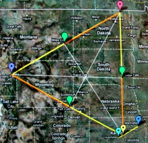
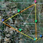
TWO: The Triangle. Plotting the locations of three key crop circle locations in my research of US formations from 1995 through 2002 creates a near-equilateral triangle enclosing 246,792 square miles, referencing Kansas at 82,282 square miles, tripled, which equals 246,846 square miles – a difference of just 54 square miles, which is roughly the size of the overlapped triangle in the middle of the large one (apparently an artefact of the mapping process, possibly having a connection to satellite techniques and Earth curvature, since the centre of a triangle should be a point, and not another triangle). View Stace Tussel – Crop Circle Alignments in a larger map
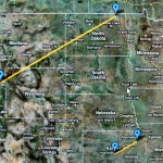
THREE: Parallel Lines. The overlay of maps one and two elicited another alignment speaking to the connectedness of all the phenomena. From a direct E-W (equatorial) line, the Inman formation appeared at an angle of 29 degrees, and the line between Langdon and Teton runs on the same parallel angle of 29 degrees. View Stace Tussel – Parallel Lines in a larger map
STACE TUSSEL COLLIGAN
NOTE: As mentioned, the potential significance of these alignments will be explored in more detail in an upcoming post.


