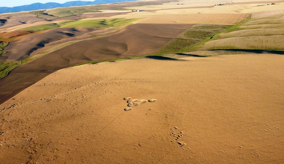
Two crop circles have appeared in the United States since my alignments map was posted in July, and each independently reveals a connection to the Other Intelligence. Both the Wilbur and Chillicothe circles, in fact, can even be read as deliberate replies to that map explication. Indeed, what other form would such a reply take?
Speculation aside about exactly how the circle came to appear in the field, consider the evidence pointing to the involvement of the Other Intelligence in Wilbur’s design and geographic placement. Through the interpretive keys of shape, synchronicity and alignment, what understanding might we derive from these new circles? Are map alignments a litmus test for communication with the Other Intelligence?
Shape and Synchronicity “Where the Lightning Strikes”
Wilbur 2012 appeared almost like a comment written in wheat a few days after I published The Sum of Its Parts: Finding Emergent Meaning in Crop Circle Maps. The diagram was immediately and intensely hypnotic; something about it drew me in completely. I found the formation’s threefold geometry graceful and balanced, echoing the triangular alignments map.
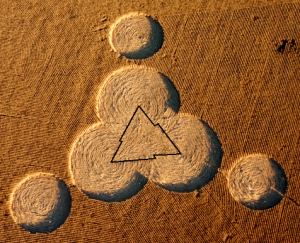 Looking past the relatively-simple outer borders of the formation we see a dynamic inner triangle in the wheat, created by the floor pattern. The triangle’s luminous zigzag border is comprised of three lightning bolts joined to form a triangle shining up from the circle’s floor. For clarity, I’ve outlined it in the photo here. What could it mean?
One book used in my research for the alignments map 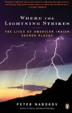 explication was Where the Lightning Strikes: The Lives of American Indian Sacred Places, by Peter Nabokov. Weeks earlier, the book had been central to a smallish synchronicity when I had first opened the it randomly to the page dedicated to Bear Butte. The zigzag feature of the Wilbur 2012 crop circle seems to be saying, “Look! Here is where the lightning strikes.”
And then there was the time lightning from a clear blue sky struck very near me in Kansas, in the utter absence of any storm – an event without mundane explanation. I associate the errant lightning with the UFO sightings and apparent ET encounters involving electricity that I was experiencing fairly frequently at the time, contact which reached a peak with the arrival of crop circles in my life in 1995.
Might electricity itself be a clue from the Other Intelligence? I just now looked online and found a brief 1985 article in The New York Times titled “Electricity May Play Role in Plant Growth.” The article reports that researchers had shown that, depending on the direction of the current, plant growth was either accelerated or stunted by the application of electricity. The premise that electricity can be applied to affect plant growth is demonstrated in my own living room, where a 4-foot tall hibiscus tree stands near the television, and the branches directly over the back of the TV set have leaves twice or three times the size of the other leaves. I wonder if the Herington, Kansas crop circle, which showed a full range of accelerated and decelerated growth while in the field, may have carried information about the potential applications of the circlemaking energy, which may be electric in nature. I haven’t yet explored possible alignment map correspondences with the Herington formation, but with this new insight in mind, another article may be in the offing.
A Path to the Pleiades Via Crop Circle Alignments
When we actively seek to interpret the messages carried by crop circles, we find that shape alone barely scratches the surface. Synchronicities help refine the unique meaning we derive from a given formation, which may in turn assist us in deciphering universal messages as well. Map placement, especially with a predictive quality, has been offered as a possible indicator of the Other Intelligence, since many of the alignments I’ve found thus far suggest an omniscient presence working behind the scenes. So naturally, the next step in deciphering Wilbur 2012 involves plugging it in to the existing alignments map.
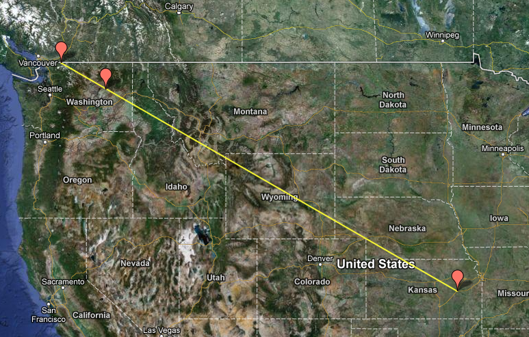
As I anticipated, Wilbur created a new and especially pertinent alignment: The 860-mile long direct line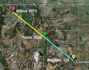 between myself and the Wilbur circle is lengthened by only two miles if we factor in a slight detour to the Teton circle.
Once this line was established, I noticed that if extended beyond Wilbur, the line continued on through the mountainous region of northern Washington. Wouldn’t it take the cake if it led directly to the Pleiades Mountain summit in the North Cascades? I was disappointed when I found the line didn’t match up, but I was compelled, nonentheless, to see if Pleiades summit showed up via any other alignments on the map. The importance of the Pleiades star system to the creation stories of the Lakota and other cultures can’t be overstated, and I’ve shared in great detail how the Pleiades infused my crop circle initiation in 1995. Because of these correspondences, I felt absolutely certain that Pleiades summit would play some role here, so I dug deeper.
Where to look next? In 1995, when all the Pleiadean connections came flooding to me in the weeks just prior to the Inman crop circle, I was living in Emporia, Kansas. That had to be it! I placed my home near 15th and West Street in Emporia on the map, extended a line from there directly to the Pleiades summit 1458 miles away, and voila! The line breezes past Wilbur 2012. My understanding of this? The crop circles, the Other Intelligence and the Pleiades are all interconnected – and by virtue of our participation we realise we are an integral part of the web of connection too.
With the addition of Wilbur and the Pleiades summit to the alignments map, it seems there is no end to the correspondences that continue to arise by intuitively exploring the encoded information. The next installment of map additions and explications is coming soon, with additional power spots and several latitude/longitude synchronicities added. Next we’ll see what happens when we factor in the location of the Hopewell Mounds crop circle near Chillicothe, Ohio.
IMPORTANT NOTE: If you are new to Flat-Map Alignments, please see FMAs: FAQs.
STACE TUSSEL COLLIGAN
Click to explore Interactive Maps!
View Crop Circle Alignments (Original Map) in an Interactive Map
View Boulder-Teton-Wilbur Line in an Interactive Map
View Emporia to Pleiades Direct in an Interactive Map
View All-in-One Crop Circle Alignments Map in an Interactive Map (overview of the current established alignments I’m in the process of explicating)
